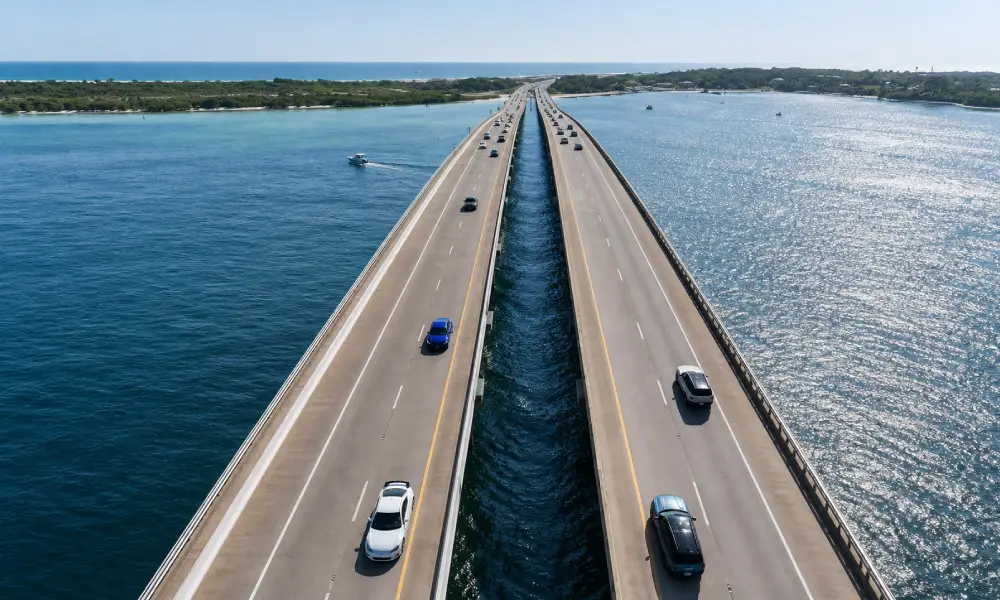
The Pensacola to Panama City Beach drive covers roughly 130 miles along Florida’s Gulf Coast, but the mileage alone does not tell you much about the route. Between the two cities are beach communities, state parks, waterfront towns, and the 30A corridor, where places such as Seaside, WaterColor, Grayton Beach, and Rosemary Beach give the middle section of the trip a very different pace.
Find the Right Vacation Rental
Traveling with family, friends, or as a couple? Compare verified rentals that fit your budget and travel style. Choose a place that feels right before you book.
This Florida Panhandle road trip guide breaks the route into manageable stops, explains where the 30A road trip fits into the drive, and highlights the best places to visit in the Florida Panhandle along the way. You’ll also find a practical map of the Florida Panhandle route, suggestions for how many days to allow, and guidance on choosing between the faster main highways and slower coastal detours.
Weather deserves attention when planning this drive. Panhandle weather can change considerably by season, with hot summers, cooler winters, and the possibility of thunderstorms and tropical systems during hurricane season. Check the forecast before setting out, especially if beach time and outdoor activities are central to your itinerary.
For a broader route comparison, see our Florida Road Trip Itinerary guide, which covers other regional drives and planning options.
| Worldwide Most Popular Travel Destinations |
|---|
Table of Content
- Why Is It Called the Florida Panhandle?
- Pensacola to Panama City Beach: Route and Drive Time
- Florida Panhandle Road Trip Map
- Best Places to Visit Along the Panhandle
- Florida Panhandle Weather: What to Expect
- Where to Stay Along the Panhandle
- Florida Panhandle Road Trip FAQs
- More Related Blogs From Travel Recommendations
Why Is It Called the Florida Panhandle?
The Florida Panhandle gets its name from the shape of the state on a map. The region forms a long, relatively narrow strip of land extending west from Florida’s main peninsula, resembling the handle of a cooking pot. It stretches along the northern Gulf Coast from the state’s western border near Pensacola across to the Tallahassee area and beyond, depending on how the region is defined.
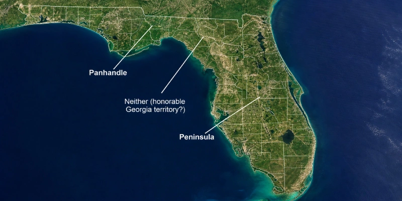
Unlike the broader Florida peninsula, the Panhandle has a distinct east-west shape that makes the nickname easy to understand when looking at a map of Florida’s Panhandle. The region also has its own coastal travel areas, including the Emerald Coast, 30A, and the beaches around Panama City.
For this Florida Panhandle road trip, the most useful part of the region is the Gulf Coast stretch between Pensacola and Panama City Beach. That route brings together several beach communities and coastal stops without requiring you to cross the entire Panhandle.
Pensacola to Panama City Beach: Route and Drive Time
The Pensacola to Panama City Beach drive is roughly 100 miles via US-98, making it one of the easier coastal drives in Florida to complete in a single day. With no extended stops and normal traffic, the journey takes under two hours. That short distance gives you plenty of flexibility to turn the drive into a road trip rather than treating it as a simple transfer between two cities.
US-98 is the main east-west route for this stretch of the Panhandle, running close to the Gulf Coast through several communities and beach areas. Depending on your priorities, you can stay on the main road for a faster journey or allow extra time for coastal detours and stops.
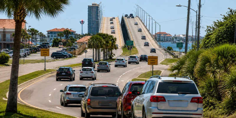
For a Florida Panhandle road trip, the route is particularly useful because the drive itself does not require several days. You can spend a morning in Pensacola, make stops along the Emerald Coast, explore part of the 30A road trip corridor, and reach Panama City Beach by evening. Travelers with more time can spread those stops across two or three days instead of trying to cover everything in one push.
The route also works well as an add-on to a longer Gulf Coast itinerary. Rather than setting aside an entire week just for Pensacola and Panama City Beach, you can incorporate this stretch into a broader Florida trip and use the extra days for beaches, state parks, towns, or other places to visit in the Florida Panhandle.
Florida Panhandle Road Trip Map
A Florida Panhandle road trip map is useful for understanding how the coastal stops fit together before you start driving. The route follows the Gulf Coast from Pensacola toward Panama City Beach, with the biggest concentration of beach towns and detours around Destin and the 30A corridor.
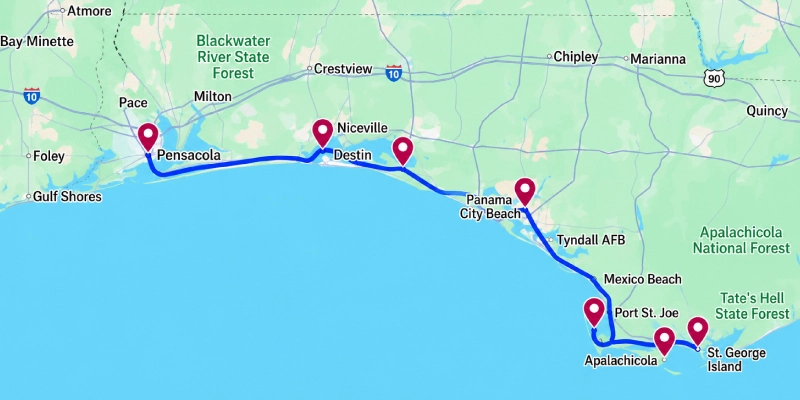
The exact route can vary depending on whether you stay on US-98 or take local roads through the beach communities. Destin marks a useful midpoint for breaking up the drive, while the 30A road trip section adds several smaller coastal towns between Destin and Panama City Beach.
On a map, this route covers only a small portion of the full Panhandle, so travelers with extra time can extend the itinerary west toward Perdido Key or east beyond Panama City Beach. For a straightforward Pensacola-to-Panama City Beach trip, however, the coastal corridor above covers the main stops most visitors are looking for.
Best Places to Visit Along the Panhandle
A Florida Panhandle road trip works best when you treat the coast as a series of distinct areas rather than one continuous stretch of beach. Pensacola has the strongest historical focus, Destin anchors the Emerald Coast, 30A brings a cluster of smaller beach communities, and Panama City Beach provides a busier finish. Each stop can fill a few hours or more, depending on how much time you have.
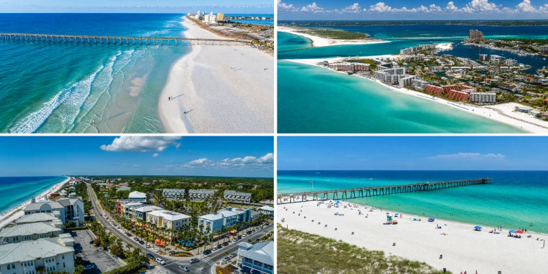
Pensacola and Pensacola Beach
Pensacola is a useful starting point because the city gives the western end of the route more to do than simply stopping for the beach. Downtown Pensacola has historic buildings, restaurants, and museums, while the National Naval Aviation Museum is one of the area’s major attractions. History is also prominent at the local fort sites, including Fort Pickens on Santa Rosa Island.
After exploring the city, Pensacola Beach provides the coastal portion of the stop. The island has several beach access points, so you can build in time by the Gulf before continuing east. If you’re allowing two or three days for the trip, Pensacola works well as the first overnight rather than trying to cover the city and immediately continue toward Destin.
The Emerald Coast: Destin and Surrounding Area
The Emerald Coast road trip section begins around the stretch of Northwest Florida coastline known for its clear, green-tinted Gulf waters. The name generally refers to the coast around Destin and neighboring communities, although the exact boundaries can vary depending on who is defining the region.
Destin is the main hub along this part of the route. Its harbor is central to the city’s identity, with fishing charters, boat trips, restaurants, and waterfront activity. The surrounding beaches provide plenty of opportunities for a longer stop, while nearby communities such as Fort Walton Beach and Miramar Beach give you alternatives to staying directly in Destin.
For a road trip, Destin is also a practical place to slow down. Traffic can make the coastal drive take considerably longer than the map suggests, particularly during busy travel periods, so allowing several hours here is more realistic than treating it as a quick roadside stop.
30A Road Trip
The 30A road trip refers specifically to the scenic stretch of County Road 30A running along South Walton’s Gulf Coast. Rather than being one town, 30A connects a series of beach communities, including Seaside, WaterColor, Grayton Beach, Alys Beach, and Rosemary Beach.
Each community has its own layout and atmosphere, but the appeal of this section is the ability to move between several relatively compact coastal areas along one corridor. You can stop for the beach, walk around one of the town centers, or use 30A as a slower alternative to staying on the main highway.
30A can easily take up an entire day, particularly if you want to visit several communities. For this larger Florida Panhandle road trip, think of it as a focused detour rather than something to rush through in an hour.
Panama City Beach
Panama City Beach marks the eastern end of this route and has a different feel from the smaller communities along 30A. It is a larger beach destination with extensive Gulf frontage, restaurants, entertainment, and attractions concentrated around the main tourist areas.
The beach itself is the obvious reason to stop, but the area also has access to parks and outdoor spaces for travelers who want a break from the developed beachfront. Pier Park is another major hub, with shopping, dining, entertainment, and access to the waterfront.
For a Pensacola to Panama City Beach drive, ending here gives the itinerary a clear final stop. Travelers who prefer quieter coastal towns may find 30A more suited to a slower overnight, while Panama City Beach works well if you want more activity and amenities at the end of the route.
Florida Panhandle Weather: What to Expect
Panhandle weather varies considerably by season, so the timing of your road trip can change how much time you spend outdoors. Winters are generally mild, with cooler temperatures than South Florida and occasional cold fronts that can make mornings and evenings noticeably chilly. This northern position is one reason the Panhandle does not always feel like the tropical Florida associated with Miami or the Keys.
Spring usually brings comfortable temperatures and lower humidity, making it a popular period for coastal road trips. Summers are hot and humid, with frequent afternoon thunderstorms. Beach conditions can change quickly during storms, so check local forecasts before heading out for the day.
Hurricane season officially runs from June through November, and coastal travelers should monitor forecasts when tropical systems are developing. A storm does not need to make landfall nearby to affect beach conditions, rainfall, or travel plans.
For a Florida Panhandle road trip, late spring and early fall can offer a useful balance between warm beach weather and the intense heat of midsummer. Winter can also work well for sightseeing and exploring towns, although swimming conditions may be less appealing. Pack according to the season rather than assuming Florida’s weather is consistent statewide.
Where to Stay Along the Panhandle
Where you stay can change the pace of a Florida Panhandle road trip, particularly around Destin and 30A. These areas have plenty of hotels, but vacation rentals are especially common in the smaller beach communities, where low-rise properties and residential neighborhoods sit close to the coast. A rental can also make more sense for travelers planning several nights in one location rather than changing hotels every day.
For the 30A portion of the route, consider a Travelarii vacation rental in Seaside, WaterColor, Rosemary Beach, or another nearby 30A community. Staying within the corridor reduces the need to drive back and forth along the highway when exploring its individual beach towns.
-
Florida Panhandle
5 Bed 4 Bathroom Town Home★ 3.0(4) Check priceView Property -

Florida Panhandle
Runaway Beach Resort by Magical Memories★ 2.8(10) Check priceView Property -
Florida Panhandle
Regal Palms Resort & Spa 1327★ 3.4(58) Check priceView Property -
Florida Panhandle
5 Bed 4 Bathroom Town Home★ 3.0(4) Check priceView Property -
Florida Panhandle
Runaway Beach Resort by Magical Memories★ 2.8(10) Check priceView Property -
Florida Panhandle
Regal Palms Resort & Spa 1327★ 3.4(58) Check priceView Property
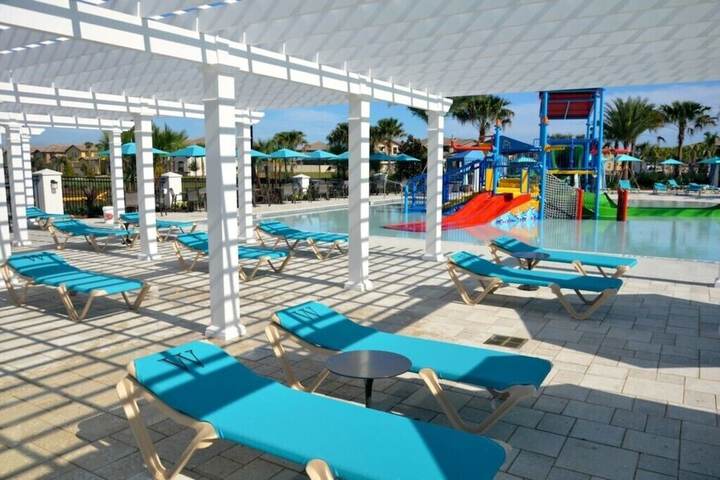
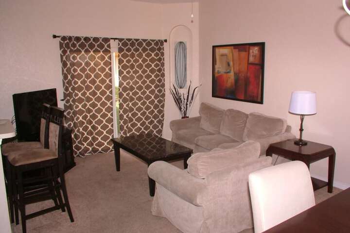
For travelers spending more time around Destin, a Travelarii rental near Destin or Miramar Beach provides another option, particularly for families or groups that need more living space.
Use Travelarii’s Panhandle and Emerald Coast listings to compare available properties by location, dates, and property type. Booking in advance is especially useful during peak beach seasons, when popular 30A communities can have limited availability.
Florida Panhandle Road Trip FAQs
The name comes from the region’s shape on a map. The Florida Panhandle is a long, relatively narrow strip extending west from the main peninsula, resembling the handle of a pan. It runs along Florida’s northern Gulf Coast and includes cities and beach communities such as Pensacola, Destin, and Panama City Beach.
The Pensacola to Panama City Beach drive is roughly 100 miles and takes under two hours without significant stops, depending on traffic and your exact starting and ending points. For a road trip, however, plan considerably more time if you want to visit Destin, 30A communities, beaches, or other coastal stops.
30A refers to a scenic stretch of County Road 30A along South Walton’s Gulf Coast. It connects several beach communities, including Seaside, WaterColor, Grayton Beach, and Rosemary Beach. It is worth adding to a Florida Panhandle road trip if you have enough time to slow down and explore several towns rather than simply driving through.
The Emerald Coast generally refers to the Gulf Coast around Destin and nearby communities, named for the area’s characteristic green-tinted Gulf waters. It is one section of the larger Florida Panhandle, which extends much farther west and east and includes areas such as Pensacola and Panama City Beach.
Panhandle weather changes by season. Winters are generally mild but cooler than South Florida, while summers are hot, humid, and prone to afternoon thunderstorms. Hurricane season runs from June through November, so check forecasts before traveling during this period, particularly for beach-focused road trips.
More Related Blogs From Travel Recommendations

Water activities in South Beach

Best South Beach rentals for groups and bachelor

Mid-Beach for a honeymoon

Margaret C. Jones
Margaret C. Jones, a passionate explorer of North America, captivates readers with her vivid tales on Travelarii’s blog. With a keen eye for hidden gems and local culture, Margaret offers expert advice and unique insights to enhance your travel experience. Her stories bring the diverse landscapes and vibrant cities of North America to life, inspiring readers to embark on their own adventures.