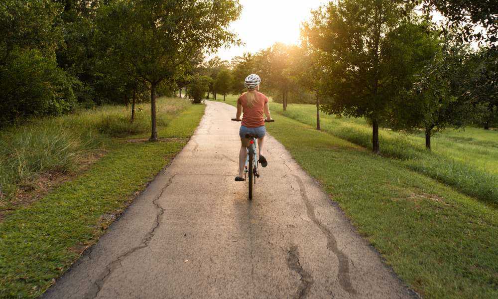
Florida is one of the easiest states in the country to bike. The Trail Surface: is flat, the winters are mild, and the state has one of the largest paved rail-trail networks in the U.S. Whether you are planning a multi-day ride across Central Florida or a short coastal loop before dinner, the 16 trails below cover the full range of what the state has to offer.

Every trail entry below is sourced directly from its managing authority – Florida State Parks, the National Park Service, or the relevant county parks department – rather than from secondary trail-review sites.
Each entry includes difficulty rating, mileage, history, wildlife, parking, and the Best Season to ride, making it easier to plan your route and book a place to stay nearby if you’re turning your ride into a weekend getaway.
| Book Hotels Near FIFA WC ’26 Stadiums |
|---|
Table of Content
- What Makes a Florida Bike Trail "Easy"?
- The 16 Best Biking Trails in Florida Reviewed in Detail
- 1. Coast-to-Coast Trail
- 2. Lake Okeechobee Scenic Trail (LOST)
- 3. Withlacoochee State Trail
- 4. Fred Marquis Pinellas Trail
- 5. Jacksonville–Baldwin Rail Trail
- 6. Boca Grande Bike Path
- 7. West Orange Trail
- 8. Legacy Trail
- 9. Shark Valley Tram Road, Everglades National Park
- 10. General James A. Van Fleet State Trail
- 11. Cady Way Trail
- 12. Suncoast Trail
- 13. Gainesville–Hawthorne State Trail
- 14. Black Creek Trail
- 15. Nature Coast State Trail
- 16. Cross Seminole Trail
- Final Words
- FAQs
- More Related Blogs From Tips & tricks
What Makes a Florida Bike Trail "Easy"?
Florida is the flattest state in the country, but “easy” still varies trail to trail. An Easy rating means a paved or hard-packed surface, grade changes under two percent, no required road crossings without a signal or marked crosswalk, and at least one rest stop with shade roughly every five miles. A Moderate rating indicates unpaved sections, longer gaps between services, occasional hills, or a higher number of uncontrolled road crossings.
None of the trails on this list require technical mountain-biking skills. The difficulty notes in each section below will help you match a trail to your group’s fitness level, tire type, and experience.
The 16 Best Biking Trails in Florida Reviewed in Detail
Each trail below is reviewed using the same criteria – difficulty, distance, trail surface, history, wildlife, parking, and the best season to ride. The list is ordered from longest to shortest, beginning with the statewide Coast-to-Coast Trail and ending with shorter routes better suited to a few hours of cycling.
1. Coast-to-Coast Trail
The Coast-to-Coast Trail is Florida’s longest connected cycling route, stretching more than 250 miles from near St. Petersburg to Titusville. It links existing trails, including the Suncoast Trail, Withlacoochee State Trail, West Orange Trail, and Cross Seminole Trail, into a statewide corridor that is still being completed.
Wildlife viewing is best from December to February, with sandhill cranes, wading birds, and gopher tortoises commonly seen along the route. Because some sections are not yet continuous, downloading offline connector maps before a long ride is recommended.
Key Things to Know About the Coast-to-Coast Trail
- Difficulty: Easy to Moderate – flat and paved on completed sections; a few road-shoulder connectors remain in unfinished gaps
- Distance: 250+ miles total; St. Petersburg trailhead is 30 minutes from downtown Tampa
- Trail Surface: Flat, paved multi-use path with planned full connectivity
- Wildlife: Sandhill cranes, wading birds, gopher tortoises (wetland sections, Nov–Feb)
- Parking: Free trailhead parking in St. Petersburg, Clermont, and Titusville
- Bike Rentals: Available in St. Petersburg and Winter Garden
- Best Season: November through April
- Best For: Long-distance riders and anyone planning a multi-day cycling trip across the state.

2. Lake Okeechobee Scenic Trail (LOST)
Wide Lake Okeechobee Scenic Trail atop the Herbert Hoover Dike with open-water views
The Lake Okeechobee Scenic Trail is a 110-mile loop around the lake atop the Herbert Hoover Dike, offering continuous open-water views. Built after the devastating 1928 Okeechobee hurricane, the dike has gradually gained paved trail sections during ongoing rehabilitation.
More than half the trail is paved, while the rest is packed gravel, making hybrid or mountain bikes the better choice. The route is completely flat but offers little shade or services, so planning ahead is essential.
Key Things to Know About the Lake Okeechobee Scenic Trail (LOST)
- Difficulty: Easy to Moderate – flat throughout, but sun-exposed with limited shade and few services
- Distance: 110-mile loop; Pahokee access point is 1 hour from West Palm Beach
- Trail Surface: Mixed – more than half paved, remainder packed gravel
- Wildlife: Herons, egrets, bald eagles, alligators (dike canals), armadillos, gopher tortoises
- Parking: Free at access points in Clewiston, Moore Haven, Pahokee, and Okeechobee
- Bike Rentals: Limited locally; most riders bring their own
- Best Season: December through March – peak bird migration and cooler temperatures
- Best For: Riders who want a long, flat, low-traffic loop with exceptional wildlife viewing. Bring sun protection and more water than you think you’ll need.
- Find Your Stay Near Lake Okeechobee: https://travelarii.com/location/united-states-of-america/florida/lake-okeechobee
3. Withlacoochee State Trail
Shaded Withlacoochee State Trail through central Florida forest
The Withlacoochee State Trail is a 46-mile flat, paved rail trail through shaded forests and small towns, with a parallel equestrian trail along its entire length. Built on a former Atlantic Coast Line Railroad corridor, it became one of Florida’s first major rail-to-trail conversions in the early 1990s.
Original railroad mile markers and a restored 1925 caboose preserve the trail’s history. The dense tree cover makes it comfortable year-round, with frequent sightings of white-tailed deer, wild turkey, and gopher tortoises near Trilby.
Key Things to Know About the Withlacoochee State Trail
- Difficulty: Easy – flat, paved, and well-shaded for nearly the full length
- Distance: 46 miles one-way; Inverness trailhead is 1 hour from Tampa
- Trail Surface: Flat, fully paved asphalt
- Wildlife: White-tailed deer, wild turkey, gopher tortoises, songbirds
- Parking: Free parking and restrooms at trailheads in Inverness, Dunnellon, and Trilby
- Bike Rentals: Available near the Inverness trailhead
- Best Season: Year-round; fall and winter carry the lowest humidity
- Best For: Families and beginners. The shade and flat grade make this one of the most consistently comfortable long rides in the state.
- Find Your Stay Near Withlacoochee State Trail: https://travelarii.com/location/united-states-of-america/florida/port-richey/withlacoochee-trail-state-park
4. Fred Marquis Pinellas Trail
Cyclist on the Fred Marquis Pinellas Trail near a waterfront town in Pinellas County
The Fred Marquis Pinellas Trail runs from St. Petersburg north through Tarpon Springs across 38 to 50 miles of flat, paved path, depending on which connector segments you ride. It follows the former route of the Orange Belt Railway, one of Florida’s earliest rail lines dating to the 1880s, and opened in stages through the 1990s.
Today it is a Rail-Trail Hall of Fame route and one of the more socially oriented trails in the state – cafes, shops, Honeymoon Island State Park, and walkable downtowns all sit within easy reach of the path, making it easy to turn a ride into a half-day outing.
Key Things to Know About the Fred Marquis Pinellas Trail
- Difficulty: Easy – flat and paved, with signaled crossings at the busiest intersections
- Distance: 38–50 miles; southern trailhead is 20 minutes from downtown St. Petersburg
- Trail Surface: Flat, fully paved
- Wildlife: Ospreys and herons near Gulf-side sections; gopher tortoises near Honeymoon Island
- Parking: Multiple trailheads in St. Petersburg, Dunedin, and Tarpon Springs
- Bike Rentals: Widely available along the route, including in Dunedin and Tarpon Springs
- Best Season: Fall through spring; summer afternoons bring heat and storms
- Best For: Casual riders who want to combine cycling with town stops and food. The best trail on this list for first-timers who don’t own a bike.
- Find Your Stay Near Pinellas Trail: https://travelarii.com/location/united-states-of-america/florida/st-petersburg-clearwater/pinellas-trail
5. Jacksonville–Baldwin Rail Trail
Riders on the Jacksonville-Baldwin Rail Trail through pine flatwoods west of Jacksonville
The Jacksonville–Baldwin Rail Trail is the only trail on this list rated Moderate, and the distinction is earned by its unpaved sections, which make up a meaningful portion of the 14.5-mile length.
The paved stretches are easy riding through wetlands and pine flatwoods, but the packed-earth sections require wider tires and more effort – particularly after rain. About halfway through, the trail passes Camp Milton Historic Preserve, where earthworks and interpretive markers tell the story of a Confederate fortification built here in 1864 during the Union Army’s advance into northeast Florida.
Key Things to Know About the jacksonville–Baldwin Rail Trail
- Difficulty: Moderate – paved sections are easy, unpaved sections require wider tires
- Distance: 14.5 miles one-way; Imeson Road trailhead is 20 minutes from downtown Jacksonville
- Trail Surface: Mixed paved and packed-earth surface
- Wildlife: Hawks, wood storks, belted kingfishers (wetland crossings); white-tailed deer near Baldwin
- Parking: Free at Imeson Road (Jacksonville) and in Baldwin
- Bike Rentals: Not available on-site; bring your own
- Best Season: Fall and winter, when unpaved sections are driest and most rideable
- Best For: Riders who want a taste of off-road Trail Surface: without a full mountain-biking commitment. Hybrid or cross bikes are better suited here than road bikes.
- Find Your Stay Near Jacksonville-Baldwin Rail Trail: https://travelarii.com/location/united-states-of-america/florida/jacksonville/jacksonville-baldwin-rail-trail
6. Boca Grande Bike Path
Flat paved Boca Grande Bike Path with Gulf of Mexico views on Gasparilla Island
The Boca Grande Bike Path runs 6.5 miles along the length of Gasparilla Island, following the route of a former phosphate railroad that once shipped freight from the island’s deepwater port.
At the southern end, the historic Boca Grande Lighthouse – built in 1890 – marks the trail’s end and is one of the more photogenic stops on any short Florida cycling route. The path is fully paved, entirely flat, and has no major road crossings. Fort Myers is roughly an hour away.
Key Things to Know About the Boca Grande Bike Path
- Difficulty: Easy – flat, short, fully paved, no significant traffic crossings
- Distance: 6.5 miles one-way; about 1 hour from Fort Myers
- Trail Surface: Flat, fully paved
- Wildlife: Ospreys and dolphins (harbor side); manatees near the marina in cooler months
- Parking: Public parking near the Boca Grande Lighthouse and at multiple points along the path
- Bike Rentals: Available on the island, including cruiser-style bikes suited to the flat Trail Surface.
- Best Season: Winter and early spring for comfortable temperatures and open services
- Best For: Casual cyclists, photographers, and anyone combining a beach visit with a relaxed, low-effort ride
- Find Your Stay Near Boca Grande Bike: https://travelarii.com/location/united-states-of-america/florida/port-charlotte-charlotte-harbor/boca-grande-beach
7. West Orange Trail
Paved West Orange Trail running past a lake near Winter Garden, Florida.
The West Orange Trail runs 22 miles through Winter Garden and several lakes on the western edge of the Orlando metro, opened in 1995 on a former Atlantic Coast Line Railroad corridor.
It is one of the better-connected trails in the region, linking to the broader Coast-to-Coast network heading east, and is widely credited with sparking the redevelopment of downtown Winter Garden into the walkable district it is today. Bike Rentals are available in downtown Winter Garden, a short ride from the main trailhead.
Key Things to Know About the West Orange Trail
- Difficulty: Easy – flat, fully paved, with regular rest stops and restrooms
- Distance: 22 miles one-way; Winter Garden trailhead is 25 minutes from downtown Orlando
- Trail Surface: Flat, paved asphalt
- Wildlife: Sandhill cranes and wading birds near Lake Apopka crossings; ospreys nesting in spring
- Parking: Trailhead parking in Winter Garden and Apopka
- Bike Rentals: Available in downtown Winter Garden
- Best Season: Year-round; one of the more shaded and amenity-rich trails near Orlando
- Best For: Beginners and Orlando-area visitors who want an easy ride with access to food and shops along the route.
- Find Your Stay Near West Orange Trail: https://travelarii.com/location/united-states-of-america/florida/orlando/west-orange-trail
8. Legacy Trail
Legacy Trail connecting Sarasota and Venice along a paved former railroad corridor
The Legacy Trail is an 18.5-mile flat, paved rail trail connecting Sarasota and Venice, with seven trailheads offering free parking. Sarasota County purchased the former CSX corridor in 2004, opened the original section in 2008, and completed the downtown Sarasota extension in 2022.
Originally built as a Seaboard Air Line Railroad in 1911, the trail still features its original milepost markers. The easy route includes signalized road crossings, and surrey and pedicab rides are available on the southern section from late January through mid-April.
Key Things to Know About the Legacy Trail
- Difficulty: Easy – flat, paved, with controlled crossings at all major intersections
- Distance: 18.5 miles; about 15 minutes from downtown Sarasota
- Trail Surface: Flat, fully paved; rest areas approximately every mile
- Wildlife: Gopher tortoises, bald eagles, scrubland birds between Sarasota and Nokomis
- Parking: Free at seven trailheads including Culverhouse Nature Park, Oscar Scherer State Park, Patriots Park, and the Historic Venice Train Depot
- Bike Rentals: Available near the Sarasota end via Popcycles and other local shops
- Best Season: November through April; busiest January to March during snowbird season
- Best For: Riders who want a well-maintained, well-serviced trail with minimal road crossings and a consistent rest stop roughly every mile.
- Find Your Stay Near Legacy Trail: https://travelarii.com/location/united-states-of-america/florida/sarasota/legacy-trail
9. Shark Valley Tram Road, Everglades National Park
Shark Valley Tram Road with American alligators sunbathing along both sides.
The Shark Valley Tram Road is a 15-mile paved loop in Everglades National Park, suitable for all types of bicycles. Built in 1946 for oil exploration, it became part of the national park after the project ended, and the adjacent drainage canal now attracts abundant wildlife.
Alligators are commonly seen, especially within the first mile during winter, and may occasionally block the path. A 65-foot observation tower at the halfway point provides panoramic Everglades views. The trail begins off US-41, about 40 minutes from Miami.
Key Things to Know About the Shark Valley Tram Road
- Difficulty: Easy – flat, paved 15-mile loop; no shade available on the trail
- Distance: 15 miles round-trip; entrance is 40 minutes from Miami
- Trail Surface: Flat, paved tram road; no rough Trail Surface
- Wildlife: Alligators (near-certain in winter), herons, egrets, wood storks, soft-shell turtles
- Parking: At the Shark Valley Visitor Center; park early on winter weekends – the lot fills
- Bike Rentals: On-site at $27/day; open 8:30 a.m.– 4:00 p.m.; must return by 5:00 p.m.; book online in advance for winter weekends
- E-bike rules: Class 1 and 2 e-bikes permitted; 15 mph speed limit; no pets on the tram road
- Fees: Everglades National Park entrance fee applies
- Best Season: December through March for wildlife and temperature; avoid summer heat and no-shade exposure
- Best For: Wildlife viewing – this is the most reliable trail in Florida for guaranteed alligator sightings at close range.
- Find Your Stay Near Everglades National Park: https://travelarii.com/location/united-states-of-america/florida/everglades-national-park
10. General James A. Van Fleet State Trail
Long, straight Van Fleet State Trail through the Green Swamp wilderness.
The General James A. Van Fleet State Trail is a 29.2-mile paved rail trail through the Green Swamp, with only one slight curve and three road crossings. Built on a former Seaboard Air Line Railroad corridor, it opened as a dirt trail in 1992 and was fully paved by 1997.
The stretch between Green Pond Road and Bay Lake Road offers the best wildlife viewing, with chances to see alligators, deer, bald eagles, and the rare Sherman’s fox squirrel. The trail is named after General James A. Van Fleet, a Polk City native and Korean War commander.
Key Things to Know About General James A. Van Fleet State Trail
- Difficulty: Easy – flat, straight, paved, only three road crossings in 29.2 miles
- Distance: 29.2 miles; Polk City trailhead is 35 minutes from Orlando
- Trail Surface: Flat, fully paved 8-foot-wide asphalt path
- Wildlife: Alligators, white-tailed deer, wild turkey, gopher tortoises, bald eagles, wood storks, barred owls
- Parking: Free at four trailheads – Polk City, Green Pond, Bay Lake, and Mabel – each with restrooms and picnic pavilions
- Bike Rentals: Not available on-site; bring your own
- Best Season: Year-round, but little shade makes summer rides very hot – bring more water than expected
- Best For: Riders who want a genuinely remote, quiet trail away from urban sprawl. The least crowded trail on this list by a significant margin.
- Find Your Stay Near General James A. Van Fleet State Trail: https://travelarii.com/location/united-states-of-america/florida/lakeland-winter-haven/gen-james-a-van-fleet-state-trail
11. Cady Way Trail
Shaded Cady Way Trail paved path connecting Orlando and Winter Park through residential greenway
The Cady Way Trail is a 7.2-mile paved corridor linking Orlando and Winter Park, managed by Orange County Parks and Recreation.
It opened in 1994 along a former railroad right-of-way, and according to Orange County’s official trail page, it has averaged more than 500,000 users per year since the mid-2010s.
The trail sits about four miles northeast of downtown Orlando and connects directly to the Cross Seminole Trail at its eastern end – making it a key entry point into the broader regional trail network heading toward Seminole County and beyond. An Emergency Response Marker system runs every tenth of a mile along the path for safety.
Key Things to Know About the Cady Way Trail
- Difficulty: Easy – flat, paved, with signaled crossings throughout
- Distance: 7.2 miles; about 4 miles northeast of downtown Orlando
- Trail Surface: Flat, paved asphalt; mostly well-shaded
- Wildlife: Urban trail – expect songbirds and squirrels rather than larger species
- Parking: Trailheads at Cady Way Park (Winter Park), Lake Druid Park (Orlando), and Herndon Avenue near the U.S. Post Office
- Bike Rentals: Not available on-trail; closest rentals in Winter Park
- E-bike rules: Class 1 and 2 e-bikes permitted; Class 3 prohibited on all Orange County trails
- Best Season: Year-round; shaded for most of its length
- Best For: Short rides near Orlando, commuter-style outings, and as a connector to the Cross Seminole Trail for longer regional loops.
12. Suncoast Trail
Suncoast Trail running north from Tampa alongside the Suncoast Parkway through Pasco County
The Suncoast Trail is a 42-mile paved route through Hillsborough, Pasco, and Hernando counties. Opened in 2001, it is part of Florida’s Statewide Greenways and Trails System, with about 23 miles overlapping the Florida Coast-to-Coast Trail.
Pasco County’s 21.6-mile section includes two wildlife viewing areas. The stretch beside Jay B. Starkey Wilderness Park is the most scenic, while the long, smooth path makes the trail especially popular with road cyclists.
Key Things to Know About the Suncoast Trail
- Difficulty: Easy to Moderate – flat, but sun-exposed with highway noise and limited shade on most sections
- Distance: 42 miles; Lutz Lake Fern Road trailhead is 25 minutes from Tampa
- Trail Surface: Flat, fully paved; some rolling sections north of SR 50
- Wildlife: Two dedicated viewing areas in Pasco County; armadillos occasionally on trail
- Parking: Trailheads at SR 54, Crews Lake Wilderness Park, Anderson Snow Regional Park, and SR 50; some trailheads charge a parking fee
- Bike Rentals: Available at Trek Land O’Lakes nearby
- Best Season: Fall through spring; summer exposure makes midday riding uncomfortable
- Best For: Road cyclists who want long, uninterrupted mileage on smooth pavement. Less rewarding for casual riders or those who prefer more scenic rides.
13. Gainesville–Hawthorne State Trail
Paved Gainesville–Hawthorne State Trail entering Paynes Prairie Preserve State Park with an observation platform visible
The Gainesville–Hawthorne State Trail is a 16-mile paved rail trail connecting Gainesville’s Boulware Springs Park with Hawthorne through Paynes Prairie Preserve State Park. Opened in 1992 on a former railroad corridor, it includes a parallel equestrian trail for much of the route and begins at the restored 1892 Boulware Springs pumphouse.
Paynes Prairie Preserve is the trail’s highlight, with nearly 300 recorded bird species, plus alligators, wild horses, and American bison. The mostly flat route is rated Easy to Moderate, making it suitable for most cyclists and runners.
Key Things to Know About the Gainesville–Hawthorne State Trail
- Difficulty: Easy to Moderate – mostly flat, with notable hills and curves in the first few miles near Gainesville
- Distance: 16 miles between Gainesville and Hawthorne
- Trail Surface: Flat to gently rolling paved asphalt; paved spur to scenic overlooks inside the preserve
- Wildlife: American bison, wild horses, alligators, sandhill cranes, bald eagles, otters, deer, and nearly 300 recorded bird species
- Parking: Trailheads at Boulware Springs City Park (3300 SE 15th St, Gainesville), Rochelle (Prairie Creek Preserve), and Hawthorne
- Bike Rentals: Available in Gainesville at several local shops
- Trail hours: Boulware Springs open 8 a.m.–6 p.m. November–April; 8 a.m.–8 p.m. May–October
- Best Season: Fall through spring for the most comfortable riding and best wildlife activity
- Best For: Wildlife enthusiasts and anyone who wants a trail that offers genuine ecological variety, including the only realistic chance of spotting wild bison on a Florida bike trail.
14. Black Creek Trail
Paved Black Creek Trail along Fleming Island in Clay County with the waterway visible through the trees.
The Black Creek Trail is an 8-mile paved path on Fleming Island, about 25 minutes from Jacksonville. It follows US Highway 17, connects three county parks along Black Creek, and offers a flat, free route suitable for all skill levels.
This is a local trail rather than a destination ride, making it ideal for a short, low-traffic outing or pairing with a kayaking trip on Black Creek. Nearby, the Black Creek Ravines Conservation Area adds forest and ravine scenery for those willing to leave the paved trail.
Key Things to Know About the Black Creek Trail
- Difficulty: Easy – flat, paved, and suitable for all ages
- Distance: 8 miles; about 25 minutes from Jacksonville
- Trail Surface: Flat, fully paved
- Wildlife: Wading birds and waterfowl along the creek; forested habitat in adjacent conservation area
- Parking: Free at Black Creek Park (7890 US-17, Fleming Island) with restrooms and water fountains
- Bike Rentals: Not available on-site
- Best Season: Year-round; expect heavier weekend cyclist use
- Best For: A short, easy outing near Jacksonville without a long drive or a full-day commitment.
15. Nature Coast State Trail
Paved Nature Coast State Trail with the historic Suwannee River railroad trestle near Old Town
The Nature Coast State Trail is a 31.7-mile paved rail trail connecting Cross City, Trenton, Fanning Springs, and Chiefland through the Suwannee River Valley. About 40 minutes from Gainesville, it follows former Atlantic Coast Line Railroad corridors and is designated as both a Florida State Trail and a National Recreation Trail.
Its standout feature is the 1902 Suwannee River railroad trestle near Old Town, with the sunken paddle steamer City of Hawkinsville beneath it. Historic train depots remain along the route, and during cooler months, riders may spot leaping Gulf sturgeon and wintering manatees near the river.
Key Things to Know About the Nature Coast State Trail
- Difficulty: Easy – flat, paved, and rural throughout
- Distance: 31.7 miles across two alignments; Fanning Springs trailhead is 40 minutes from Gainesville
- Trail Surface: Flat, paved asphalt
- Wildlife: White-tailed deer, wild turkey, gopher tortoises, gulf sturgeon (river crossing), manatees (winter)
- Parking: Free trailheads in Chiefland (23 SE 2nd Ave), Trenton (419 N Main St), Fanning Springs, Old Town, and Cross City
- Bike Rentals: Not available on-site; bring your own
- Best Season: Fall and winter for the best temperatures and manatee/sturgeon viewing near the river
- Best For: History buffs and riders who want a genuinely rural trail away from the coast, with a one-of-a-kind railroad trestle crossing as the highlight.
16. Cross Seminole Trail
Cross Seminole Trail through the cypress forest of Spring Hammock Preserve near Oviedo, Florida.
The Cross Seminole Trail is a 23-mile paved route linking Winter Park to Lake Mary, where it connects with the Cady Way and Seminole Wekiva trails. Opened in 2002, it was the first trail in the U.S. designated a Purple Heart Trail, and part of the route is included in the Florida National Scenic Trail.
Spring Hammock Preserve is the trail’s scenic highlight, featuring a boardwalk through old-growth cypress forest and “The Lady,” a bald cypress growing beside the site of the historic 3,500-year-old Senator tree. The trail also connects with the Sanford Riverwalk and Spring to Spring Trail, making it a key link for longer rides around the Orlando area.
Key Things to Know About the Cross Seminole Trail
- Difficulty: Easy to Moderate – mostly flat and paved, with more road crossings in the urban sections near Lake Mary
- Distance: 23 miles; southern trailhead is 20 minutes from downtown Orlando
- Trail Surface: Flat to gently rolling paved path; boardwalk sections through Spring Hammock Preserve
- Wildlife: Cypress forest birdlife and old-growth tree scenery through Spring Hammock Preserve
- Parking: Trailheads at Big Tree Park (Longwood), Greenwood Lakes Park (Lake Mary), and the Aloma/Howell Branch intersection
- Bike Rentals: Available in Winter Park and downtown Oviedo
- Best Season: Fall through spring for the most comfortable conditions
- Best For: Riders who want to combine a longer regional route with a notable natural landmark stop. Also the best entry point for anyone building a multi-trail ride across the greater Orlando area.
Final Words
Florida’s extensive trail network makes it easy to find a ride that matches your time, experience, and interests. Whether you’re looking for wildlife, history, quiet scenery, or long-distance mileage, these trails offer dependable options across the state. Use the information in this guide to plan confidently and enjoy more time on the bike.
FAQs
The Withlacoochee State Trail, Fred Marquis Pinellas Trail, West Orange Trail, and Legacy Trail are consistently among the best fully paved options in the state. All four are flat, well-maintained, and suited to riders of any experience level, with restrooms, parking, and Bike Rentals accessible along each route. For something with more wildlife and ecological variety, the Gainesville–Hawthorne State Trail and Shark Valley Tram Road both belong on any shortlist.
The Florida Department of Environmental Protection’s Office of Greenways and Trails publishes official state trail maps and maintains a searchable trail finder. County parks departments – including Orange, Seminole, Pinellas, Clay, and Sarasota counties – all maintain current maps for locally managed trails on their official websites. The NPS publishes Shark Valley trail maps at nps.gov/ever.
The West Orange Trail, Van Fleet State Trail, and the Cady Way and Cross Seminole trails cover the range of Central Florida options well, from relaxed lakeside rides to remote rural stretches. For riders who want a connected long-distance route, the Coast-to-Coast Trail links most of these together into a single corridor running coast to coast across the state.
Yes. Santos Trailhead in Ocala, managed by the Ocala Mountain Bike Association, offers more than 80 miles of single-track and is considered one of the best mountain bike destinations in the Southeast. Alafia River State Park in Lithia is another well-regarded off-road network. The unpaved sections of the Jacksonville–Baldwin Rail Trail offer a lighter off-road option for riders not ready for full single-track.
Yes, and on some trails it is essentially guaranteed. Shark Valley in Everglades National Park is the most reliable option – alligators are commonly seen within the first mile on winter mornings, and dozens may be visible on a single ride. The Lake Okeechobee Scenic Trail, Gainesville–Hawthorne State Trail, and Van Fleet State Trail all offer regular alligator sightings near canals and wetland crossings.
More Related Blogs From Tips & tricks


Margaret C. Jones
Margaret C. Jones, a passionate explorer of North America, captivates readers with her vivid tales on Travelarii’s blog. With a keen eye for hidden gems and local culture, Margaret offers expert advice and unique insights to enhance your travel experience. Her stories bring the diverse landscapes and vibrant cities of North America to life, inspiring readers to embark on their own adventures.